|
||||||||||||||||||||||||||||||||||
|
||||||||||||||||||||||||||||||||||


|
|||||||||||||||||||||||
 |
|||||||||||||||||||||||
| - | |||||||||||||||||||||||
|
||||
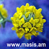
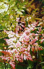
NORTHWEST OVERVIEW MINERALS, STONES, GEMS FLORA BIRDS OTHER FAUNA THERMAL and MINERAL SPRINGS Overview Half of the region lies on the Kars and Shirak Plateaus, a complex mountain steppe region that includes swamp and marshland, large tracts of semi-desert, mountain steppe and mountain/alpine meadows with pockets of forests nestled inside mountain clefts. The Southern area relies mainly on irrigation and springs to cultivate agriculture. The landscape is striking, if for some visitors a little desolate. The main highways run through the driest parts of the region, which give a false impression: There are as many villages in Shirak region as there are in Aragatsotn, all of them built along rivers, streams and springs. An amazing number of early medieval monasteries and churches were built on the plateau (which is dotted with dozens of mountains itself), each of them a verdant oasis in the surrounding semi-desert. The rock formations and scrub land vegetation that makeup the bulk of southern Shirak are unique Eco-systems, filled with desert wildlife, and the bulk of migrating steppe birds in the Spring and fall. Armenia's second city, Giumri, lies in the center of Shirak Region. Giumri holds the best examples of what the belle epoque life was like in 19th century Armenia. While most of the Kruschev era buildings were destroyed in the 1988 earthquake, a large part of the old quarter survived the devastation, and many buildings that were partially destroyed are being rebuilt. The city lies above the Akhurian River Valley, which supports deciduous forests along its path. Between Giumri and the Georgian border, the land slowly rises to the foot of the Javakh Range. The area is notorious for being the coldest area in Armenia throughout the year, though it is a rich marshland with scattered swamps that supports waterfowl and possibly the highest altitude habitat for the stork and crane. The region is primarily inhabited by Molokons, descendants of Russian Orthodox "Old believers", first exiled by Catherine the Great. Forest birds and other fauna inhabit the pockets of forestland that suddenly erupt into a deep forest at the Georgian border. Minerals, Stones, Gems Flora Lower Elevation sagebrush steppe flora includes Gladiolus atroviolaceus, Nigella oxypetala, Actynolema macrolema, Gundelia tournefort, Verbascum saccatum, Lallemanita iberica, Roemeria retracta, Scabiosa argentea, Scorronera paposa, Muscari beglecta, Stchys inflata, Astragalus distyophysus, A. kochianus, Achillea tenuifolia, Helichrysum rubicundum, Silena spergulifolia. River Gorge flora include Alkanna orientalis, Cerasus incana, Prus, salicifolia, Cerasus mahaleb, Amygdalus ferzlinia, Spirala crenata, Saxifraga cymbalaria. Desert and semi-desert flora include (non Latin names) sagebrush, steppe grass, straw flowers, poppies and daisies. Birds Other Fauna Thermal and Mineral Springs
Climate
Change Info Center-Armenia
INDIVIDUAL REPORTS
|
| |
Search | |
||||||