Sevan
CENTRAL (GEGHARKUNIK)
TourArmenia -
Overview
Gegharkunik is surrouned by dormant volcanic mountains. On the Southwestern edge are the Geghama Lehr (Geghama Mountain Range), on the south and southeastern rim lie the Vardenis Mountain Range, and to the east and northeast lie the Sevan and Areguni Mountain Ranges. All the mountains were formed over millions of years by a series of volcanic eruptions.
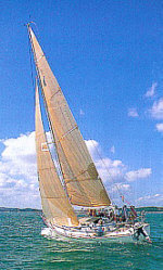
The heart of Gegharkunik is Lake Sevan, which was known in ancient times as the Gegham Sea. Lake Sevan is divided into two sections: Big Sevan and Small Sevan. Big Sevan is 972 square kilometers, with a maximum depth of 46 meters. Small Sevan is 284 square kilometers, with its maximum depth at 99 meters. The lake is 1897 meters above sea level. The lake is fed by 28 rivers and streams, and is the source for the Hrazdan River, which connects Sevan with the Arax River in the Ararat valley, and is the site where a 1 million BCE Homo sapiens skull was discovered near Bjini.
The lake is graced with pebble and granular sand beaches on all sides, and the formation of a Nature Preserve in the 1970’s has created some of the most dramatically beautiful wilderness areas in the country. A rare mountain lake marshland on the Southernmost side is home to wetland birds never seen at this altitude in other parts of the world, among them the Stork and Pelican. The lake itself is home to a protected species of Ishkhan (a trout called the Prince of fish) and Sig, which are officially protected from capture, but often appear on beachside restaurant menus.
The lake is in jeopardy and has been the focus of constant study (but little actual assistance) from the United Nations, the World Bank, and before that, the Soviet regime. For more information, see Ecological Concerns.
 TOP TOP
Minerals, Stone, Gems
The mountains are formed from lava rocks like basalt, perlite and limestone, while tectonic plate compression created marble, and granite. Minerals and soil include clay, peat, molibden, gold, copper and silver, while gems include diamonds. Since most of the region is protected, very few mines are in operation (or admitted to be operating), the most notable exception being the gold mine at Sodk.
TOP
Flora
Sevan Shore flora include Prangos ferulacea, Eremurus spectabilis, Tulipa julia, Iris paradoxa, iris caucasica, Scutellaxia orientalis, Crambe orientalis, Cleome ornithovodioides, Gypsophila elegans, Senecio vernalis, Silene chlorantha, Reichardia dichotoma, Srophularia olgae, S. armeniaca, S. grossheimii, Artemisia absinthium, Spiraea crenata.
Sevan Pass and mountain flora include Iris furcata, Anemone fasciculata, A. raminculoides, Primula ruprechtii, P. macrocalyx, Trollius patulus, Caltha polypetala, Veratium lobelianum, Palsatilla armena, Corydalis persica, Fritillaria caucasica, Betonica grandiflora, Prunus spinosa, Sedum pilosum, Sempervivum transcaucasicum, Malus orientalis, Pyrus caucasicus.
TOP
Birds
Click for Birds By Habitat: Mountain Steppe Wetland, Rocky Cliff, Mountain Slope, Woodland / Farmland / Orchard, Forests / Open Forests, Subalpine / Mountain Meadow.
TOP
Other Fauna
Wild Armenian Goat, Wild Ram, mountain leopard (endangered species), wild bore, fox, wildcat, Ishkhan and Sig.
TOP
Thermal and Mineral Springs
Most of the springs in Gegharkunik are by Gavar and Martuni, including fresh water, naturally chlorinated, naturally carbonated and sulfur carbonate. The springs are located by Gavar, Martuni, Karadzi at Argichi River, Sarukhan, Tzovak and close to the Sulemi Pass in the Geghama Lehr. One spring lies at T'tujur, north of Chambak.
TOP


LINKS
Images (photos
by Tigran Nazarian)
EcoCenter
Ecotourism.com
(currently down, but try in case)
EcoTeam
Development
Armenian Flora/Fauna Stamps
Climate
Change Info Center-Armenia
ERMC
National Academy of
Sciences of Armenia
Protected
Areas of Armenia
Map
of Sevan National Park
INDIVIDUAL REPORTS
Threatened
Species in Armenia
State
of Environment Report 2000 (UN)
 write TourArmenia -
 Top
Top

|